
The partnership: a synergy of expertise
In the heart of California's wine country, the source article states that LakeTech and Aquatic Resource Management embarked on a collaborative journey to redefine aquatic mapping standards. Using the BioBase Portable Bathymetric Mapping Backpack System, the partnership aims to accurately map lakes in the Napa and Sonoma regions.
The article frames the initiative as supporting sustainable management and conservation in ecologically rich areas, not only charting water bodies. LakeTech is described as bringing environmental solutions, while Aquatic Resource Management is described as a leader in aquatic ecosystem preservation.
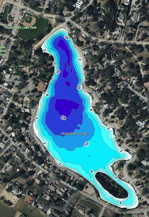
- Detailed maps for aeration design: use accurate maps to properly design suitable aeration device locations.
- Product application amounts: apply the necessary amounts of products using an accurate map.
The technology: BioBase Portable Bathymetric Mapping Backpack System
At the center of the venture is the BioBase Portable Bathymetric Mapping Backpack System, described in the source article as fit-for-purpose technology designed for precision and efficiency.
The portable system maps water bodies in detail and provides data on depth, contours, and vegetation. The article notes that portability and ease of use make it well suited to the varied and sometimes challenging terrain of the Napa and Sonoma regions.
A live-page image caption attributes field use of the backpack to Eli Kersh and Anthony Domenici.
Why accurate water mapping matters
The source article states that accurate bathymetric maps are crucial tools for environmental managers, policymakers, and conservationists.
- Water quality management: depth and structure help predict how factors such as temperature stratification, sediment accumulation, and pollutant dispersion affect water quality.
- Habitat preservation: detailed maps help identify critical aquatic habitats and guide conservation and restoration projects.
- Flood risk assessment: accurate maps support better flood predictions and flood management strategies.
- Resource management: in regions such as Napa and Sonoma, knowing exact water body volume aids efficient resource allocation and sustainability efforts.
Impact beyond mapping
The source article states that the LakeTech and Aquatic Resource Management collaboration, facilitated by the BioBase system, goes beyond creating accurate maps. It is presented as a precedent for using technology in environmental conservation.
Data gathered through the project is described as supporting immediate management of Napa and Sonoma water bodies and contributing to long-term sustainability and conservation efforts in the region.
A closing section on the live page summarizes the partnership as bringing advanced bathymetric mapping to Napa and Sonoma using the BioBase Backpack System for effective environmental management and conservation.