
The Shoreline You Cannot Walk To
Most invasive vegetation work is a question of scheduling. You know what is growing, you know roughly when to treat it, and you send a crew. The hard part is usually the calendar.
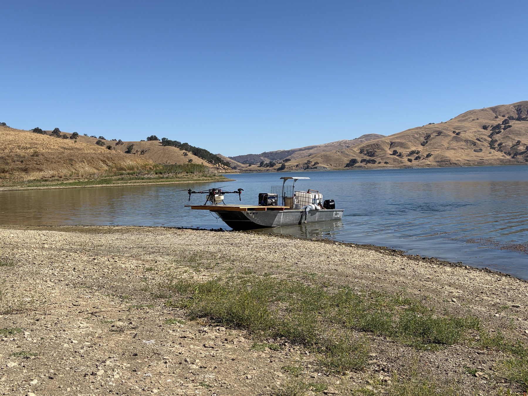
Calaveras Reservoir is not that. The reservoir sits in a steep bowl in the hills south of Sunol, and a good portion of its shoreline is not shoreline in any useful sense. It is rock face, loose slope, and ravines that run straight down into the water. There is no road to most of it, no bank to stand on, and nothing a truck, an ATV, or a crew with backpack sprayers can safely work from. The vegetation that needs attention is frequently in exactly those places, because those are the places nothing else competes for.
That is the problem worth solving. Not what to treat, but how to physically get a treatment to ground that will not let you stand on it. LakeTech partnered with Ag-Bee to spot treat invasive species throughout the SFPUC watershed, and the answer started with a boat.
- Steep rock faces and ravines that drop directly into the reservoir
- No road access to much of the shoreline
- No safe footing for backpack sprayers or ground rigs
- Invasive vegetation concentrated in the least accessible terrain
Where This Is: The SFPUC Alameda Watershed
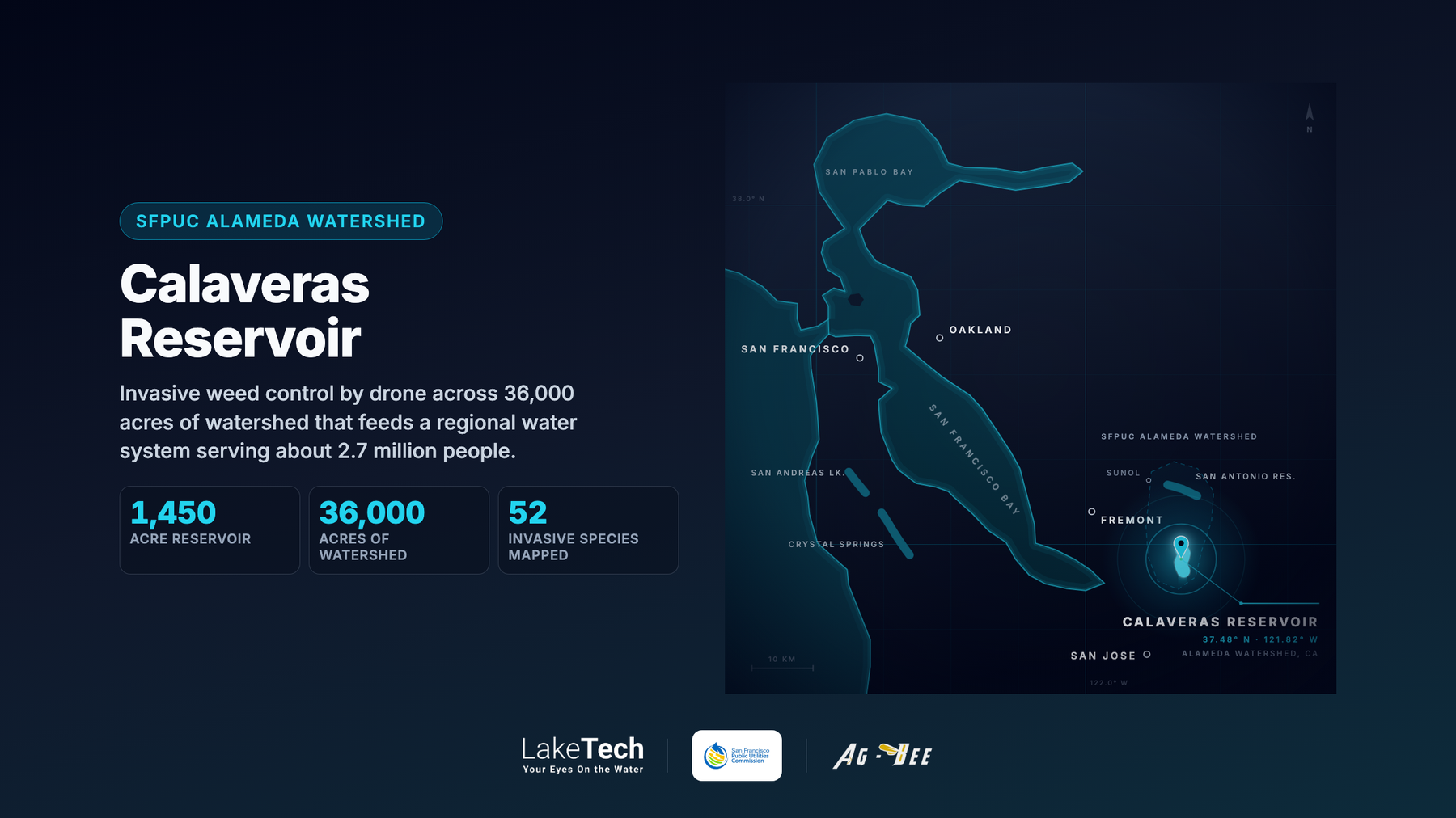
Calaveras Reservoir is owned by the City and County of San Francisco and operated by the San Francisco Public Utilities Commission. It covers roughly 1,450 surface acres on Calaveras Creek, near the Santa Clara and Alameda county line, and holds about 96,850 acre feet at its design capacity. Its dam was rebuilt under the Calaveras Dam Replacement Project, completed in 2019.
The reservoir does not sit on its own. It is one piece of the SFPUC Alameda Watershed, roughly 36,000 acres of watershed land spanning both counties, which also holds San Antonio Reservoir to the north. Water stored here supplements Sierra Nevada supply in a regional system that serves roughly 2.7 million people across San Francisco, San Mateo, Santa Clara, and Alameda counties.
Scale is the reason vegetation management on these lands is a standing program rather than a one off job. An SFPUC commissioned invasive plant inventory across its watershed lands mapped 52 invasive plant species, which gives you a sense of the size of the problem a watershed team is managing against. That figure describes the watershed inventory, not the outcome of any single treatment, but it explains why access to difficult ground matters so much. Terrain that cannot be reached is terrain that cannot be managed.
- About 1,450 surface acres, roughly 96,850 acre feet at design capacity
- Owned by the City and County of San Francisco, operated by SFPUC
- Part of an Alameda Watershed of roughly 36,000 acres
- Supports a regional system serving about 2.7 million people
- Rebuilt dam completed in 2019 under the Calaveras Dam Replacement Project
The Boat Becomes the Runway
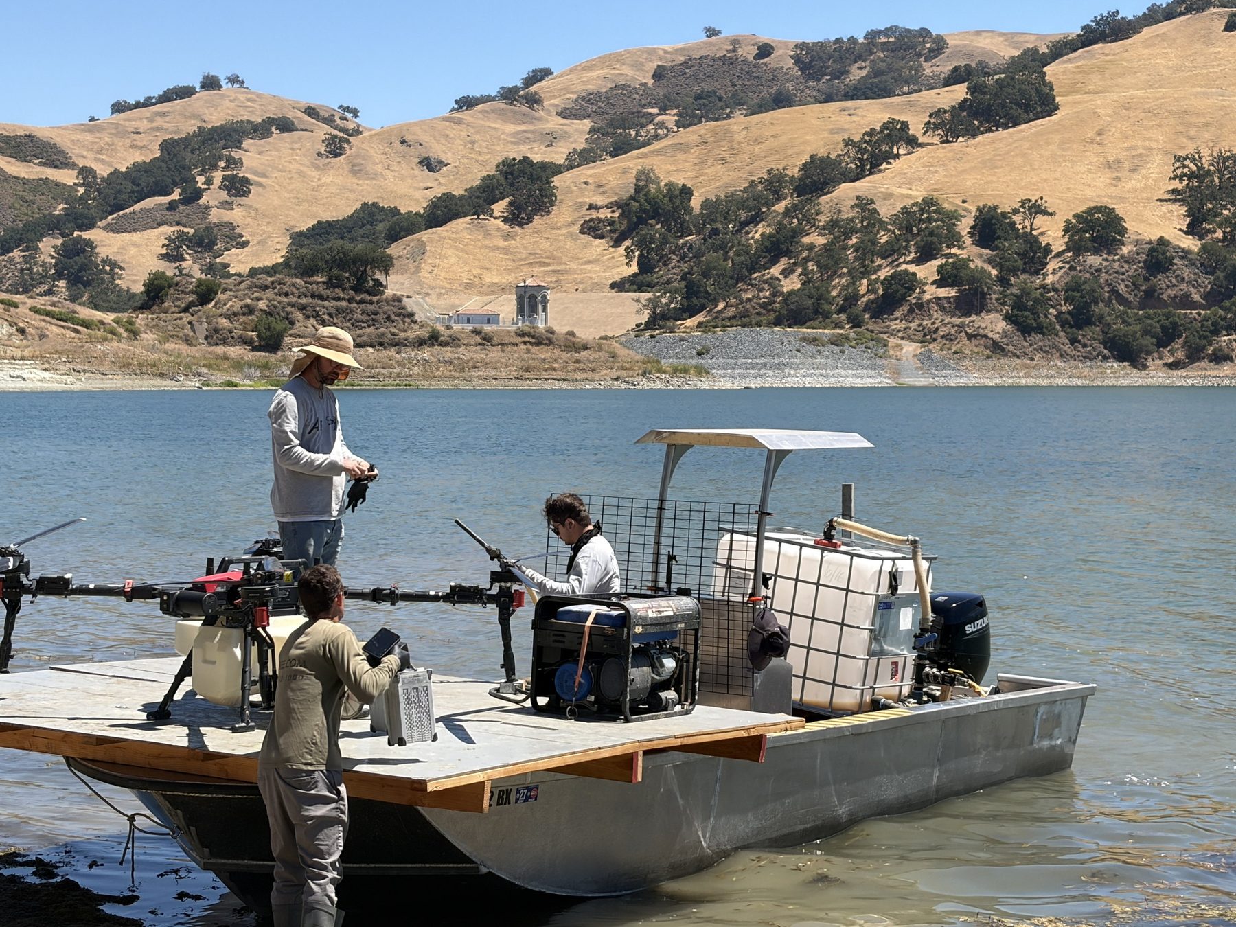
If you cannot reach the shoreline from the land, the remaining option is to reach it from the water. That is what this operation is built around, and it is simpler than it sounds once you see it laid out on the deck.
The crew loads a flat deck aluminum barge with everything an application needs to be self sufficient: the spray drone, a mix tank, a generator, and the crew themselves. The barge launches from the ramp, runs out across the reservoir, and beaches or holds position near the section of shoreline being worked. From there the deck is the launch pad. The drone lifts off the barge, flies the terrain, treats its target, and comes back to reload. Then the barge moves and the sequence repeats somewhere else.
What this buys is reach. A ground crew is limited to wherever it can safely park and walk from. A barge can position anywhere on 1,450 acres of water, and the drone can work outward from there into ground that no one is standing on. The reservoir stops being the obstacle and becomes the road.
- Flat deck barge carrying drone, mix tank, generator, and crew
- Launched from the boat ramp and repositioned around the reservoir
- The deck serves as the launch and reload pad
- Reach measured from the water rather than from the nearest road
- No vehicle traffic or crew footing needed on unstable bank
Why a Drone Instead of a Ground Crew
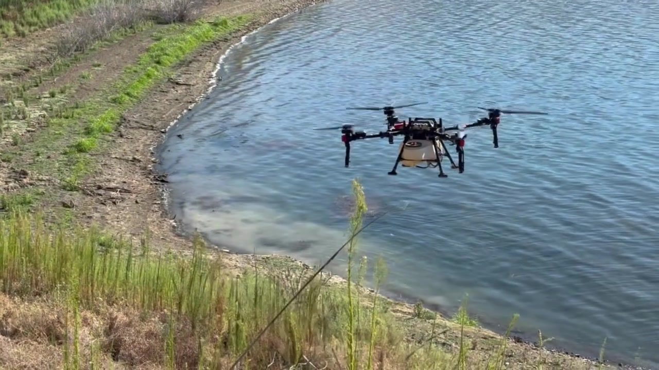
The honest answer is access first, and everything else second. On terrain like this, a drone is often the only method that can put a treatment where it needs to go without putting a person somewhere they should not be. That alone is the argument.
The secondary benefits follow from how the aircraft works. Application is targeted rather than broadcast, because the drone flies low and slow over a defined area instead of covering ground indiscriminately. Crews stay on the barge instead of scrambling a loose slope with equipment on their backs. There is no vehicle on the bank and no wake washing the shoreline, which matters on soil that is already steep and already moving. Compared to a manned helicopter, a low flying drone works a smaller, more defined area at lower cost and is easier to schedule around wind and weather windows.
It is worth being clear about what a drone does not change. It does not remove the need for permits, for a licensed applicator, or for oversight from the agency whose land and water you are working on. In California, aquatic and riparian application is a regulated activity, and it stays regulated whether the equipment has wheels, rotors, or boots. The drone changes what is reachable. It does not change what is required.
- Reaches slopes, cliffsides, and ravines that ground equipment cannot
- Targeted application over a defined area rather than broadcast coverage
- Keeps crews off unstable terrain and out of steep ground
- No vehicle on the bank and no boat wake against the shoreline
- Still requires permits, licensed applicators, and agency oversight
What This Changes for Reservoir and Watershed Managers
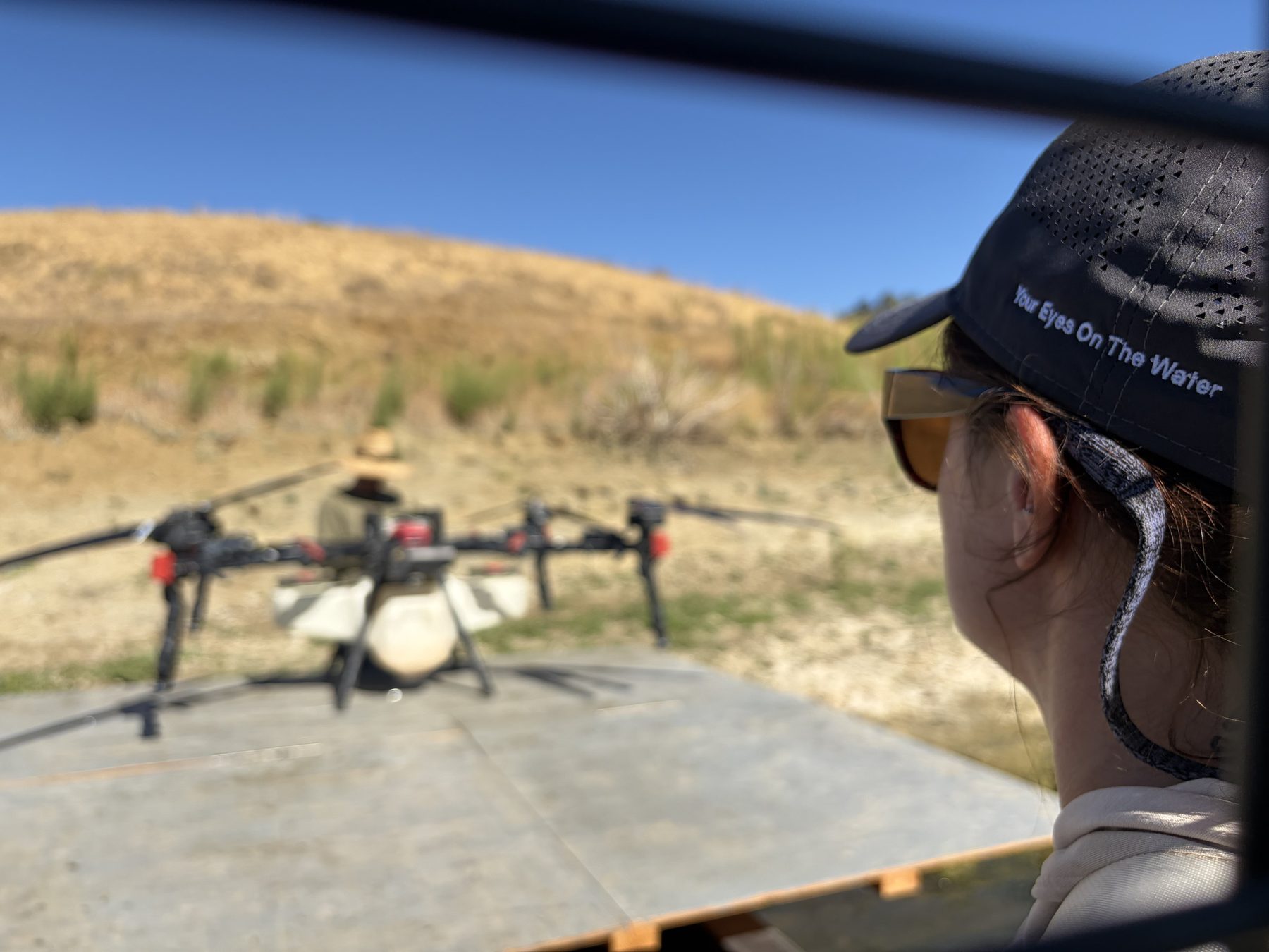
For anyone managing a large water body, the useful takeaway is not the aircraft. It is that the inaccessible portion of your shoreline no longer has to be written off.
Most reservoir and lake managers we work with carry a mental map of the parts of their water body that never get treated, never get surveyed, and never get sampled, because reaching them costs more than it seems to be worth. Those areas quietly set the ceiling on what a management program can achieve. Invasive vegetation left alone in a ravine is a seed source for everywhere downslope of it. A stretch of shoreline nobody inspects is a stretch nobody has data on.
Pairing water access with aerial application is one way to close that gap. It works best when it is planned like any other treatment: know what is out there, know what the regulatory path is, work with an applicator who is licensed for the setting, and document what happened so next season starts from a record rather than a guess. LakeTech partnered with Ag-Bee, an aerial application company based in Temecula, California, to spot treat invasive species throughout the SFPUC watershed.
If you manage a reservoir, a watershed, or a lake with terrain you have effectively given up on, that is the conversation worth having. Start with what you cannot reach and work backward from there.
- Inaccessible shoreline is usually the ceiling on a management program
- Untreated ravines act as a seed source for everything downslope
- Areas nobody can reach are areas nobody has data on
- Plan aerial work like any other treatment, with permits and licensed applicators
- Document each pass so the next season starts from a record