

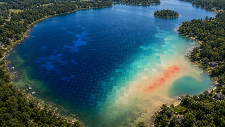
What the satellite actually sees
A field Secchi disk measures how deep a black-and-white disk remains visible from the surface. A satellite cannot see the disk, but it can measure the color and brightness of water pixels from above.
Clearer water and murkier water return different blue and red reflectance patterns. LakeTech uses Landsat Collection 2 Level-2 surface reflectance to estimate a clarity value that behaves like Secchi depth for management review.
Because Landsat has a long historical archive, the Secchi depth product is especially useful for trend context. It can help answer whether a lake is becoming clearer, more turbid, or more variable over time.
- Landsat surface reflectance measures the fraction of sunlight reflected from the surface.
- Blue and red reflectance patterns provide a practical water clarity signal.
- The output is a satellite-estimated clarity value, not a physical disk reading.
- Long Landsat history helps compare current clarity with older conditions.
- Surface optical estimates are not direct measurements of toxins, dissolved oxygen, nutrients, or whole-water-column conditions; they require local field validation and must not alone drive reopening or treatment decisions.
How LakeTech calculates the clarity estimate
LakeTech first confirms the lake boundary and finds clear Landsat scenes for the selected date range. The product then uses reflectance relationships tied to water clarity and stores the output as a Secchi-depth estimate.
The shoreline buffer matters for Secchi estimates because shallow edges, submerged vegetation, and mixed land-water pixels can distort the signal. Interior lake points are more likely to represent open-water clarity.
Once stored, the values can be compared with field Secchi readings, turbidity data, rainfall records, treatment history, and stakeholder observations.
- Clear scenes are selected before clarity values are calculated.
- Interior sampling points reduce shoreline and bottom-reflectance artifacts.
- Satellite Secchi values are best interpreted as trends and spatial patterns.
- Field Secchi disk readings remain valuable for calibration and confirmation.
Why satellite Secchi depth matters
Water clarity is one of the easiest lake conditions for residents to notice, but it can be hard to explain without data. Satellite Secchi estimates help show whether clarity changes are isolated, seasonal, storm-driven, or part of a longer-term trend.
Clarity also connects to plant growth, algae, and habitat. More light penetration can support deeper plant growth. Lower clarity can indicate suspended sediment, algae biomass, colored organics, or watershed disturbance.
By combining satellite Secchi with turbidity, chlorophyll-a, cDOM, and field notes, LakeTech can help managers separate the likely drivers behind a clarity change.
- Explain visible clarity changes with repeatable data.
- Compare shallow coves and open-water areas from the same scene.
- Evaluate whether treatments or watershed controls are changing clarity.
- Use clarity data as context for plant, algae, and photic-zone decisions.